
On June 4th, we celebrated the conclusion of the ARACNE Educational Project for the 2024–2025 school year. The 12 schools participating in the Cultural Heritage and Agricultural Landscape paths gathered online to share the results of the activities they carried out in collaboration with partners from their countries.
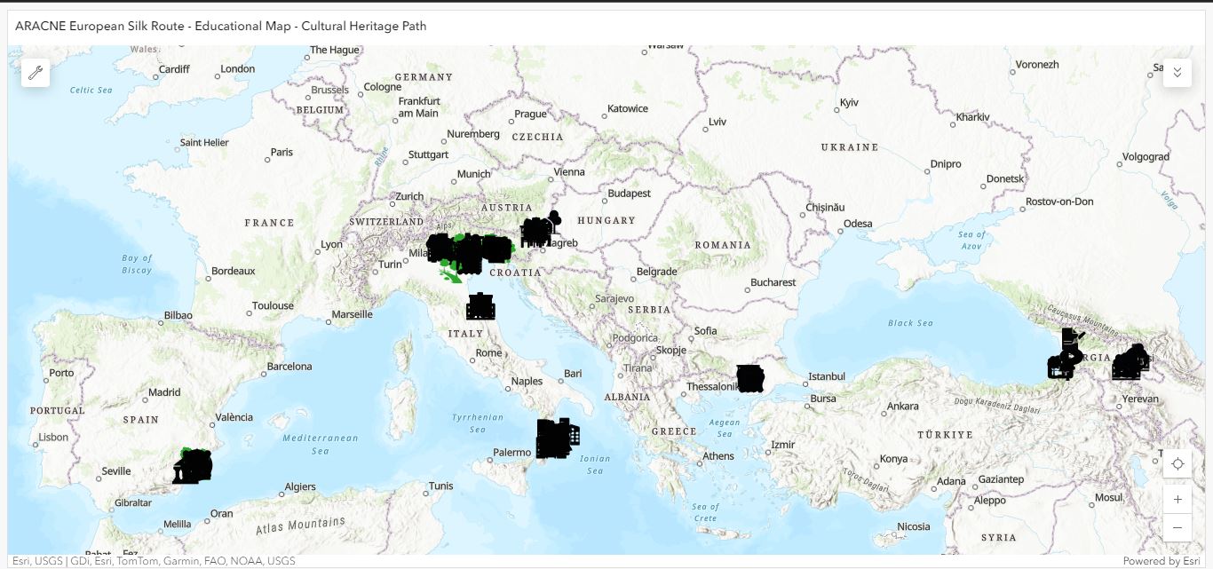
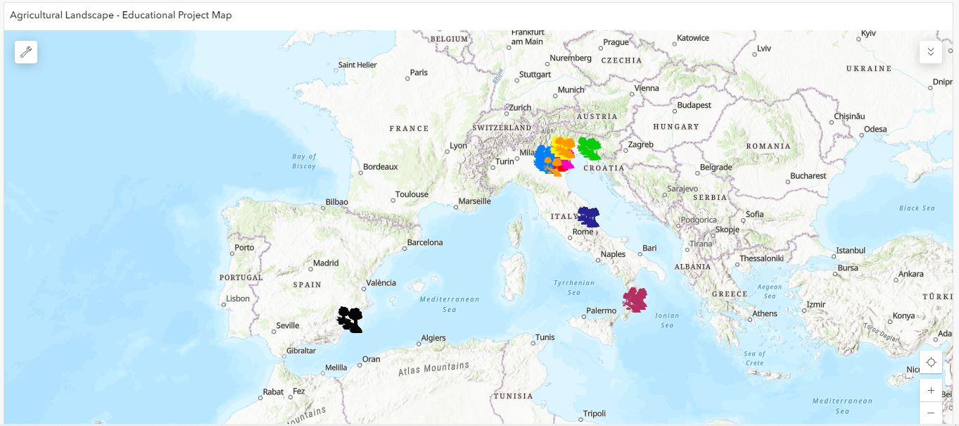
The European Silk Route Map has now taken shape and is available on the dedicated page, along with a new map for the Agricultural Landscape that displays the mulberry trees entered by students in the MorusApp.
Students from Georgia, Italy, Slovenia, and Spain presented in English the maps they created and showed the work done to document monumental mulberry trees using the MorusApp. It was an important moment of sharing and a valuable learning opportunity for all the students involved. Thanks to the dedication and passion of the teachers who guided the students throughout the process, the project achieved meaningful and high-quality outcomes.
At the end of the student presentations, the winning school for each educational path was announced.
Cultural Heritage Path
Over 50 Points of Interest (POIs) were included in the maps. A jury composed of four members, one from each participating country, assessed the maps, by rating the data entries according to three evaluation categories, assigning a score from 1 to 5 to each:
- Score for historical or landscape aspects: Evaluation of the textual content and media produced by the students.
- Score for creative and aesthetic aspects: Assessment of creative outputs (photos, artwork) and participation in workshops.
- Score for technical and ArcGIS usage: Evaluation of the process and competences used to create the map.
The winner was the Spanish school IES Salvador Sandoval, supported by the partner IMIDA, which received the highest score in every category.
Agricultural Landscape Path
In this path, over 170 mulberry trees were recorded by the students. A panel of experts assessed the data submitted via the MorusApp based on the following criteria:
- Number of records created (i.e., number of individual trees or rows of trees)
- Number of sites explored, assessing the geographical spread of the recorded trees
- Completeness of the records, based on how thoroughly the database fields were filled in
- Completeness and quality of photographic documentation
- Accuracy of geolocation, a key element for evaluation
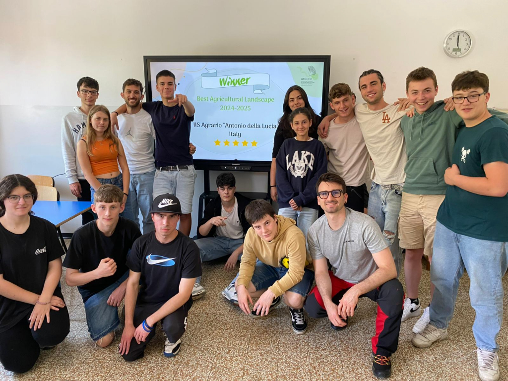
The winning school was IIS Agrario “Antonio della Lucia” from Italy, supported by the partner CREA.
Several schools also organized local events in their communities to present the map and raise awareness of their work, including Liceo Artistico Mengaroni in Pesaro (Italy), the Grammar School in Nova Gorica (Slovenia), and several schools in Georgia.
To explore the European Silk Route – Educational Map, and the Agricultural Landscape – Educational Map, to find the winning schools, and to discover the full rankings, visit the dedicated project page.